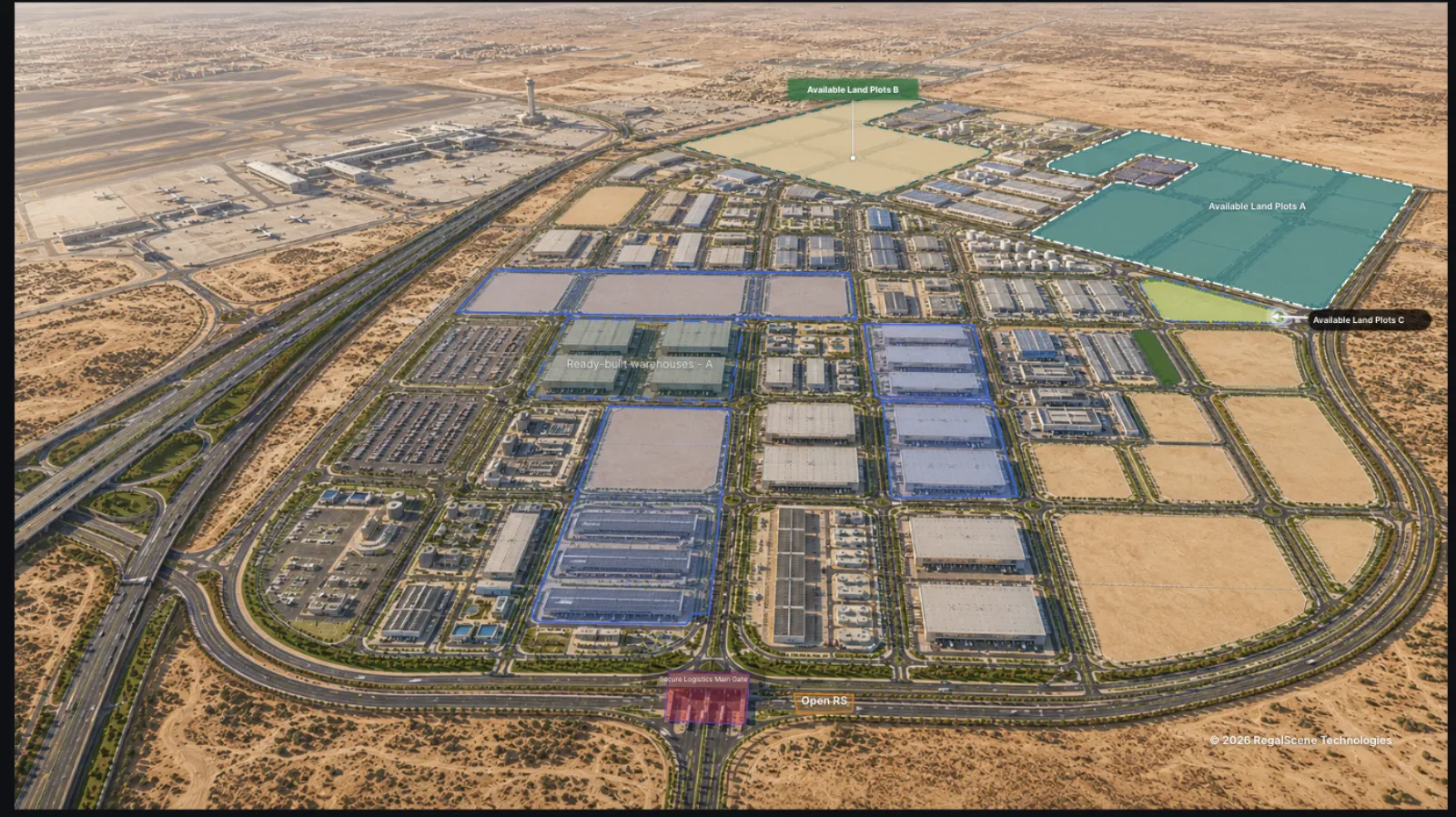
"Interactive property map" means different things depending on who's selling it. For a portal, it's pins on a city map. For a rendering studio, it's a clickable image. For a property developer trying to sell a project, it needs to be something more specific: a navigable model of your development that buyers can explore down to the individual unit — with real availability behind it.
This guide covers what that actually involves, what a good one includes, and where the term overlaps with "interactive master plan" (also written "interactive masterplan").
What is an interactive property map?
An interactive property map is your development's layout — usually built from the aerial render or site plan you already have — made navigable in a web browser. Buyers pan and zoom across the project, see zones and buildings highlighted as they explore, and click through: development → zone → building → floor → unit.
Here, the focus is the project itself as the interface, with your inventory as the data underneath. The wider geographic layer is covered separately in Web GIS for real estate portfolios, which connects locations and surrounding places to this project-level experience.
What a developer-grade property map includes
Navigable layers. A township or mixed-use project isn't one image; it's a hierarchy. The map should carry buyers from the full development into precincts, buildings, and floors without dead ends — and back out again. The same idea scales past a single project: one national or city map can hold an entire portfolio.
Current availability. Units and plots colored by real status — available, reserved, sold — updated from your inventory, not baked into the artwork. This is the single feature that separates a sales tool from a decoration.
Context that answers questions. Amenity markers, points of interest, roads and access, phase boundaries, unit details on tap — the things a buyer would otherwise call to ask, or wouldn't ask at all.
Enquiry in place. When a buyer finds the unit they want, the enquiry happens right there — and the lead arrives carrying everything the buyer was looking at.
A shareable, embeddable link. The map should live on your website, open from a QR code, and travel through WhatsApp and agent channels on any phone. If it only runs on a sales-gallery touchscreen, most of your buyers will never see it.
Interactive site maps for land developers
Not every development is a tower. Land developers — selling plots in a gated community, parcels in an industrial estate, or lots in a plotted subdivision — have the same problem in a flatter shape: a printed site map that goes out of date the moment a plot is reserved. An interactive site map solves it the same way, with parcels instead of units. Each plot is clickable, colored by current availability, and carries size, frontage, price, and enquiry in place.
"Site map," "site plan," and "property map" get used interchangeably here — the buyer doesn't care which word you use, only whether they can see what's still available and where it sits. For plotted and industrial land specifically, see interactive land and warehouse leasing.
How buyers actually use one
Watching real sessions, the pattern is consistent: buyers orient first (where is this, what's around it), then filter (which part of this project fits me), then verify (is the unit I want actually available, what does it cost), then act — enquire, or share the link with a partner and come back.
A static render supports step one. A gallery of renders supports steps one and two, barely. Steps three and four — the ones that produce transactions — need current data and interaction. That's how a map moves from marketing to conversion.
What you need to build one
Less than most developers expect:
- A high-resolution aerial render or site plan (the one from your brochure works)
- Building and unit boundary shapes — drawn in an editor or imported from SVG
- Your unit inventory — a spreadsheet is enough to start
- Renders for the levels below (building views, floor plans) as you go deeper
No 3D model, no game engine, no app store. If your visualization budget already produced renders for marketing, the map is assembled from them.
Property map vs interactive master plan: which term is right?
They overlap heavily. "Interactive master plan" usually emphasizes the top-level plan view of a development; "interactive property map" is the broader umbrella — the same navigable experience, sometimes applied to residential complexes, business parks, logistics zones, or resort layouts rather than a formal master plan document.
If you're evaluating tools, don't get caught on vocabulary: the questions that matter are the same. Does it navigate the full hierarchy? Is availability live? Do leads carry context? Can you update it yourself? Our guide to what an interactive master plan is applies to either term.
Where the map fits in your funnel
The property map is the front door: the first interactive thing a buyer touches from an ad, a hoarding QR, a portal listing, or an agent's message. Deeper layers — 360 building explorers, floor plans, unit details — do the closing work. The map's job is to make sure buyers find their way to them, and that every step of that journey is measured.
Related reading:
- Interactive Master Plan Benefits: What Property Developers Actually Gain
- What Is an Interactive Master Plan?
- Site Plan vs Master Plan vs Property Map
- Interactive Master Plans for Property Launches
- Best Virtual Tour Software for Property Developers in 2026: How to Choose
RegalScene builds interactive property maps from the renders you already have — navigable from master plan to unit, with current availability, contextual leads, and analytics. Book a demo.