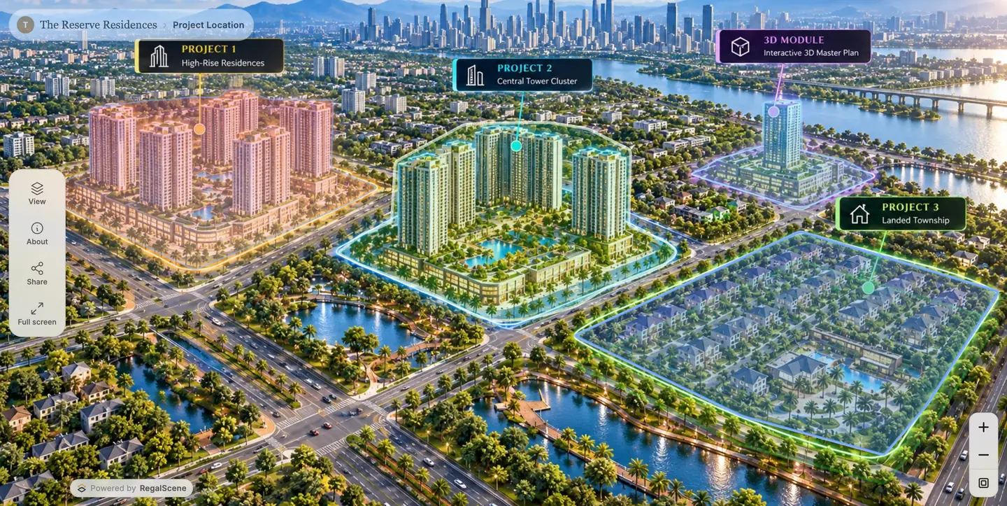
Products · Interactive Masterplan
Turn your masterplan into an interactive experience.
Static masterplans, architectural renders and building visuals become something buyers can navigate: from the whole development down to a floor, a unit and what is available on it today.
- Masterplan
- Building
- Floor
- Unit
- Enquiry
The challenge
Buyers are asked to imagine the development.
The plan is the most important thing you publish about a project, and in most launches it is the one asset that cannot answer a question.
A plan shows the project. It doesn't explain the sale.
Buyers see the layout but not which phase is selling, what each zone contains, or what is still available today.
The project arrives in pieces.
A site plan here, a floor plate there, a render in an email. The buyer has to assemble the development in their head.
Printed availability is wrong by the time it's read.
A brochure shows what was available on the day it went to print, which is rarely the day the buyer reads it.
The enquiry doesn't say where they were looking.
Sales receives “interested in your project”, not the tower, the floor or the unit the buyer had open.
The solution
One experience, from the whole site to a single unit.
The development becomes a connected experience rather than a set of files. Buyers open the plan, move into a zone, open a building, pick a floor and land on a unit with its availability, its plan and a way to enquire, without leaving what they were looking at.
It is built from the artwork you already own. The masterplan you paid for stays the masterplan buyers see.
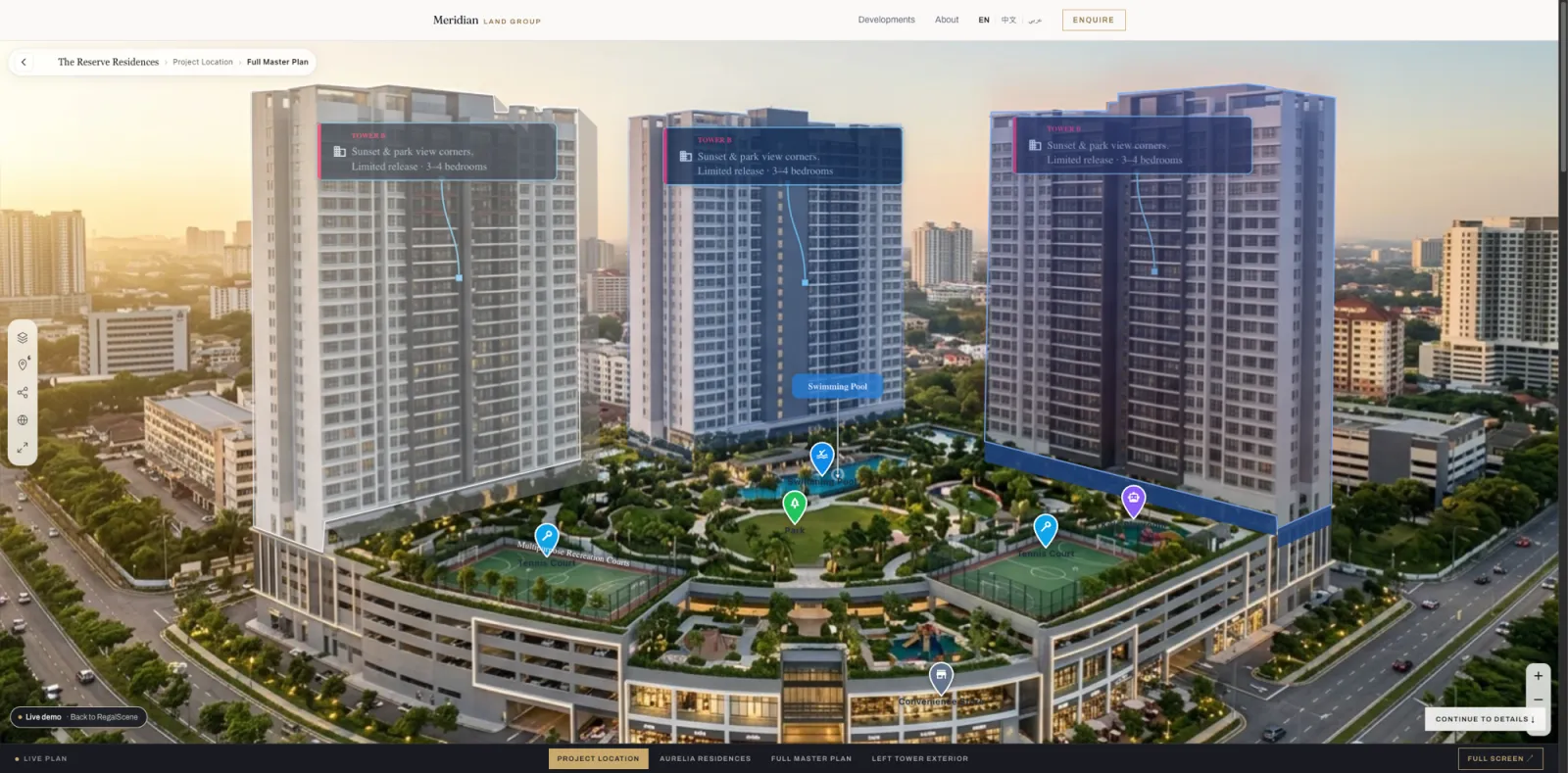
Core capabilities
What buyers can actually do.
Everything below is in the live demonstration project; none of it is a roadmap item.
The whole site, zoomable
Buyers see the development in context and zoom in without losing detail, whether it's one tower or a township.
Zones, buildings, floors, units
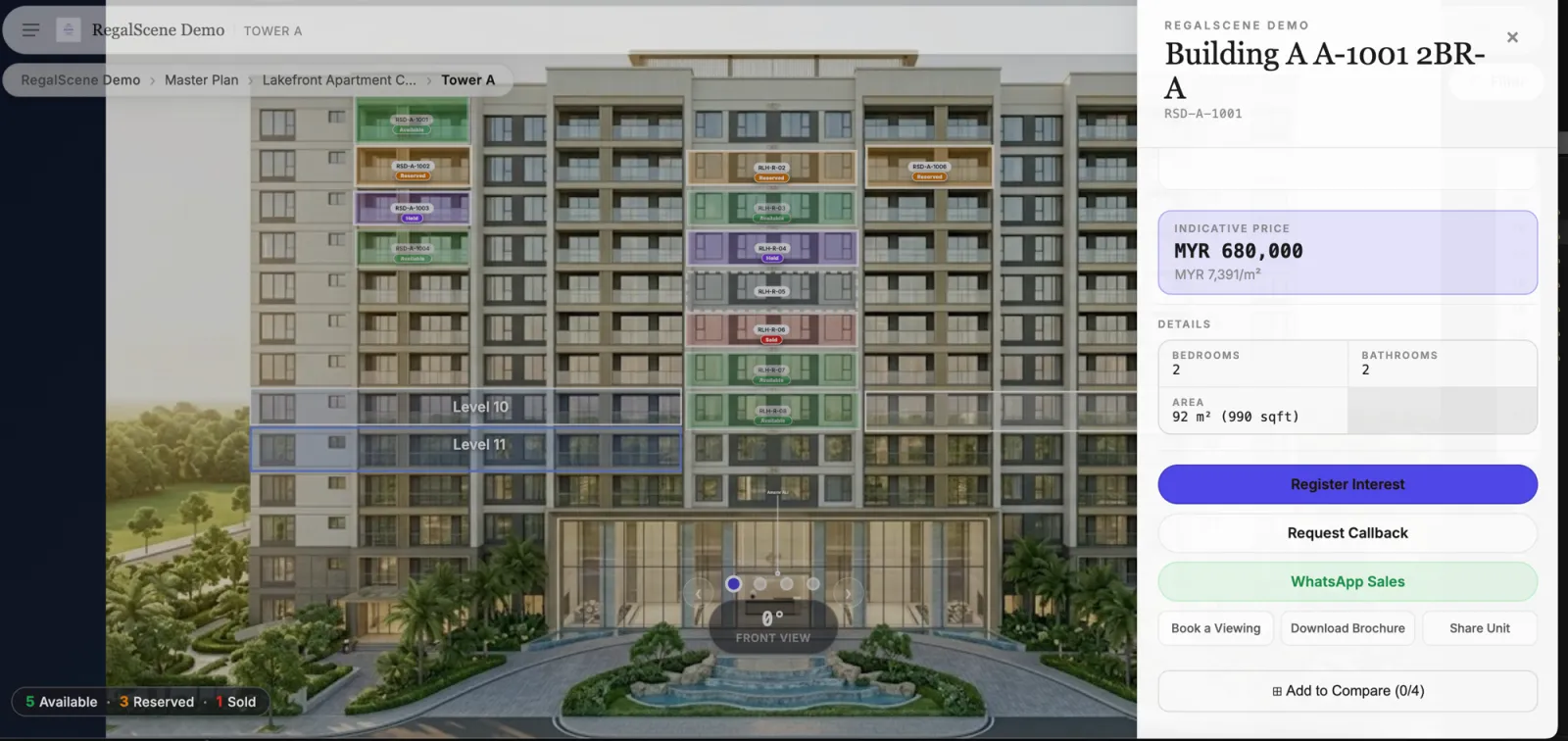
Each part opens into the next, so the journey from the masterplan down to a single unit is one continuous experience.
Interactive floor plans
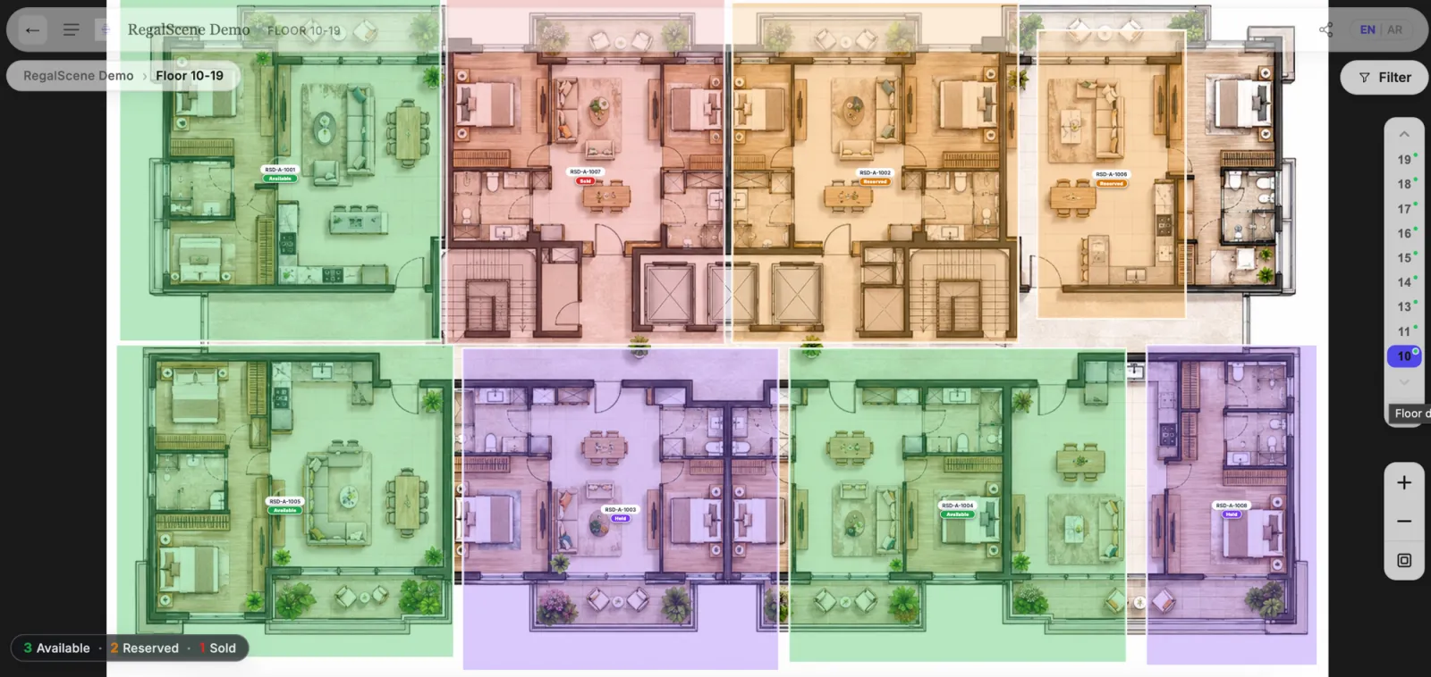
Floor plates buyers can read, with the units on them selectable rather than listed in a separate table.
Current availability on the plan
Unit status shows on the plan itself and changes as your team updates it. No reprint, no stale PDF.
Amenities and points of interest
Mark what matters around and inside the development: the clubhouse, the school, the marina, the access road.
Filter, compare and share
On the 2D plan buyers narrow by status, bedrooms, tower, floor, type, facing and price. Comparing two units side by side and sending one by link or QR code works throughout.
2D, 3D and 360
Three ways to draw the same project.
These are not three products, and they are not three prices for the same thing. The unit panel, availability, price display, compare, sharing and the enquiry are one layer underneath all of them. What changes is how the development is drawn, and that should follow what sells the unit.
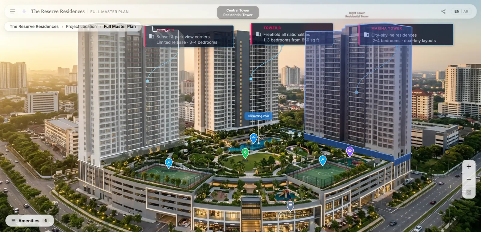
2D — plans, renders and drawings you already have
Your masterplan artwork, site plans, floor plates and aerial renders become the interactive surface directly. Nothing has to be modelled first, it stays light on any phone, and it handles very large sites and many phases comfortably. This is where most developments start.
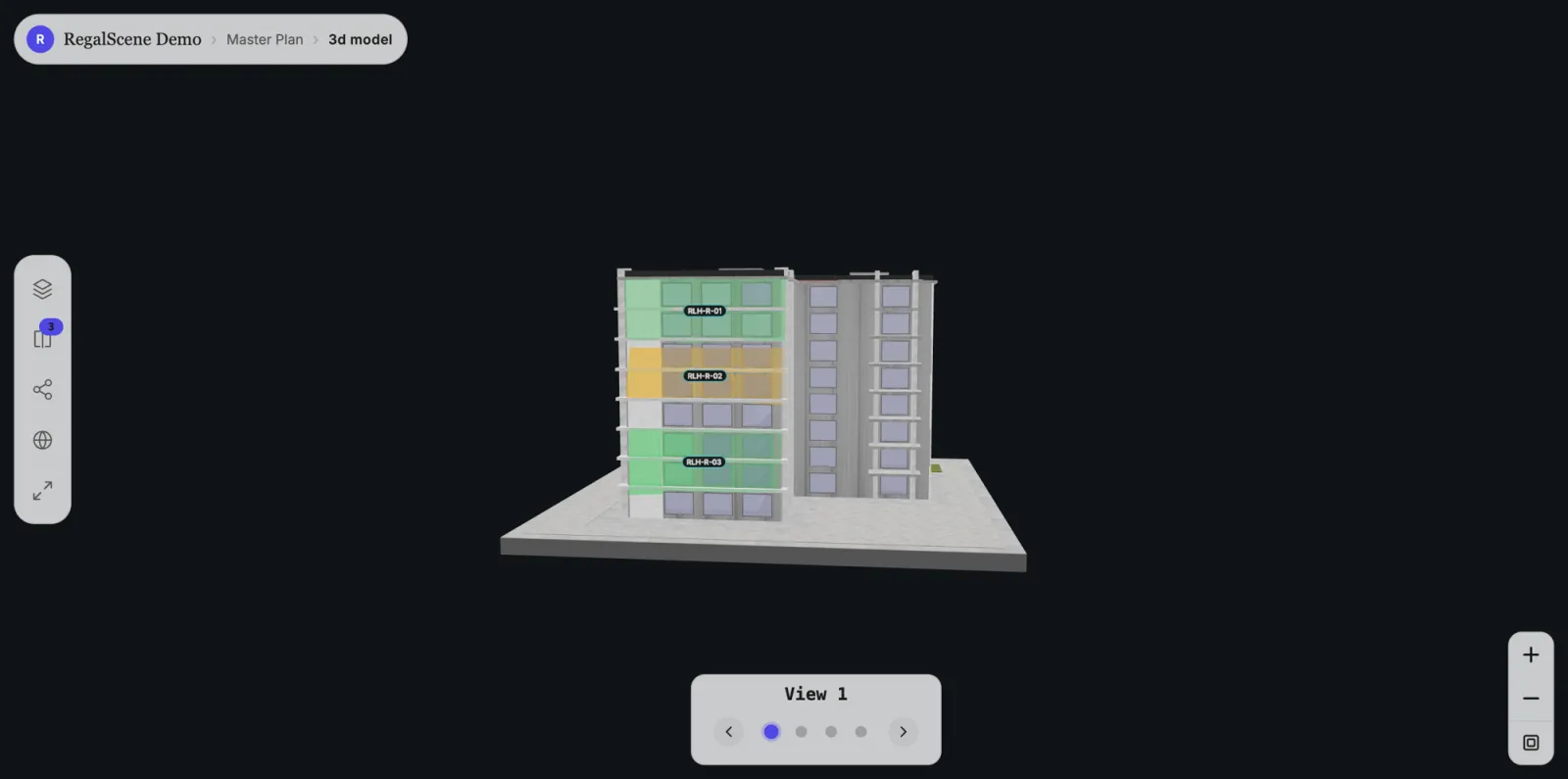
3D — when height, massing and orientation sell the unit
Where you have a 3D model, the buyer can turn the building, see which units face which way, and pick one off the facade with its current status. It is the newest of the three and narrower than the 2D plan: unit filtering, the floor selector, the labels layer, 360 and attached floor-plan PDFs are 2D features today. It needs a model to exist, so it is a choice per project and enabled project by project.
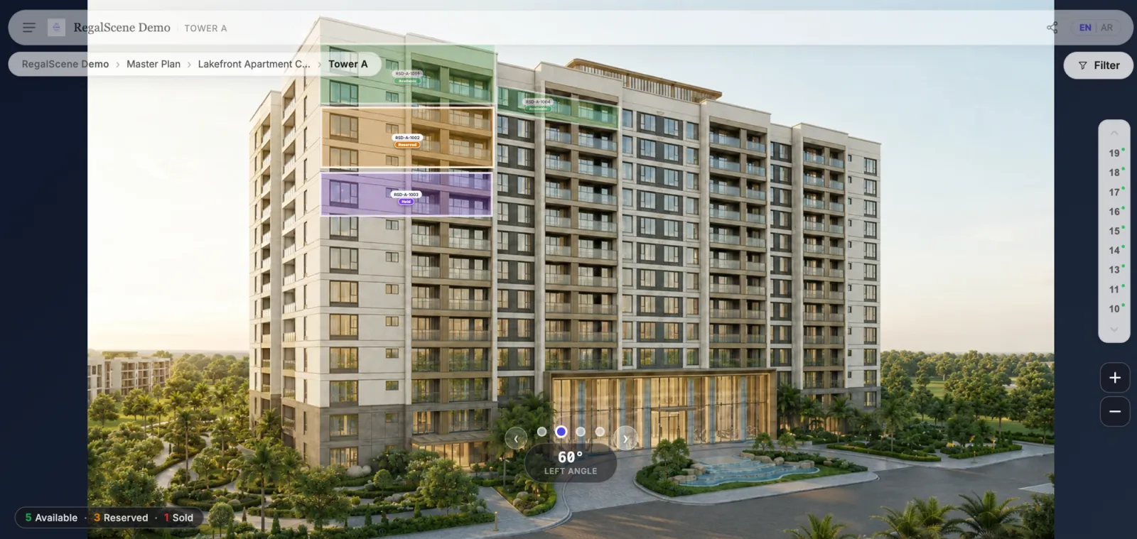
360 — standing inside the development
Panoramic views placed around the project, so a buyer can look out from a level or across a precinct before anything is built. It runs in the browser; no headset and no app.
The real thing
Don't take the screenshots for it.
The Reserve Residences is a demonstration project built in RegalScene. Open it and do what a buyer does: start at the masterplan, open a tower, find an available unit on a floor, compare it with another and send it to your phone.
Opens full screen in a new tab. No sign-up.
How it works
From your existing artwork to a live project.
- 01
Send what you already have
Masterplan artwork, site plans, floor plates, renders, and a 3D model if one exists. No new photography or new drawings are needed to start.
- 02
The project is built in RegalScene
Zones, buildings, floors and units are mapped onto your artwork, connected into a journey and linked to your unit list.
- 03
Availability is connected
Your unit schedule drives what buyers see. Your team updates status, and every surface showing that project updates with it.
- 04
It goes where your buyers are
Published as a link, embedded in your website, opened on the gallery screen, or handed to agencies — the same current experience in each.
- 05
Enquiries come back with context
An enquiry arrives with the unit it came from and the path the buyer took to reach it, so the first call starts from something real.
- 06
You see what buyers looked at
Which zones, buildings and units get attention, and where interest concentrates across the project.
Who it's for
Built for developments that are hard to explain.
The harder your project is to understand from a single image, the more an interactive masterplan does for you.
Masterplanned communities and townships
Large sites that sell over years and in phases, where the plan has to explain the whole development and still show what is on sale this quarter.
High-rise and mixed-use towers
Where the decision is the level, the orientation and the view, and a stacking plan explains more than a render.
Villa and landed precincts
Clusters of unit types across a site, where buyers compare plots and typologies rather than floors.
Resorts, hospitality and branded residences
Developments where amenities and the surroundings are much of the product, and the plan has to show both.
Logistics, industrial and commercial
Free zones, parks and warehouses, where the unit is a plot or a bay and availability still drives the enquiry.
Business benefits
What changes for your team.
Complex developments stop needing a translator
Buyers work out where things are, what is available and what it looks like without a consultant beside them explaining the plan.
Your sales team presents from one place
The same current experience in the gallery, on a laptop at a roadshow and on a phone, instead of a folder of files per person.
The project is open when the gallery is closed
Buyers explore in the evening, from another city or another country, and the enquiry is waiting in the morning.
Interest becomes information
You learn which parts of the development buyers actually open, which is a different question from which ones you promoted.
Questions
Interactive masterplan questions.
Do we need a 3D model to start?
No. Most projects start from the 2D artwork you already have: the masterplan, site plans, floor plates and renders. A 3D model adds a way to explore a building where one exists, but it is never a prerequisite.
What is the difference between the 2D and 3D versions?
The unit panel, availability, price display, compare, share and the enquiry are one layer that both use, so the commercial part behaves identically. They are not equivalent beyond that. 2D is the mature surface and carries unit filtering, the floor selector and floor stack, the labels layer, amenity directories, 360 and attached floor-plan PDFs. 3D today gives you the orbit, unit picking off the model, live status and the same enquiry. Choose 2D for large sites, phases and floor plates; add 3D for a building where height, orientation and view carry the decision.
Can buyers see live availability?
Yes. Unit status comes from the inventory your team maintains, and every published surface showing that project reflects it. How current it is depends on how often your team updates it, not on a republish.
Does it work on phones?
Yes. The experience is built for phones as well as desktop, and most buyer traffic on published projects arrives on a phone. There is no app to install and nothing to download.
Can we put it on our own website?
Yes. A project can be published as its own link or embedded in your site, and agencies can embed the same experience on theirs, each placement keeping its own attribution so you can see which channel produced the enquiry. One limit worth knowing when you plan an embed: the simplest script-tag embed does not carry 3D scenes or the geographic map, so a project leading with either is better placed as its own link or through the module-based embed.
Is this a virtual reality tour?
No. The 360 views run in a normal browser on a normal screen. There is no headset, no app and no VR requirement, which is deliberate: it keeps the experience one click away for every buyer.
Also in RegalScene
The rest of the platform.
WebGIS & Geographic Intelligence
Put every development on a real map, with boundaries, surroundings and context.
Digital Sales Gallery
The same project experience for your sales team, your agencies and every screen.

See it with your development in it.
Tell us what you're selling and send the plans you already have. We'll show you what the interactive version looks like for your project.