Products · WebGIS
See the bigger picture. Make better location-based decisions.
A geographic experience that connects your developments, their locations and what surrounds them through one interactive map, and leads from the map into each project.
The challenge
Your portfolio exists. It just isn't visible anywhere.
Location is usually the first thing a buyer asks about and the last thing a developer's digital presence actually shows.
Nobody can see the portfolio at once.
Projects live on separate pages in separate markets. There is no single view of where everything you own or sell actually is.
A dropped pin says almost nothing.
A marker gives a location. It doesn't show the extent of the site, where the entrances are, or what the project is next to.
Location is the argument, and it's in a PDF.
Proximity to the airport, the school, the coast or the expressway sells the project, and it is usually a bullet list rather than something a buyer can see.
Management sees a spreadsheet, not a map.
Where the portfolio is concentrated, and where it isn't, is a geographic question answered with rows and a lot of local knowledge.
The solution
Geography, connected to the property experience.
Google provides the geography. RegalScene provides what sits on top of it: your developments in their real positions, drawn at their real extent, with the places around them that make the location worth paying for.
The difference from a map with markers on it is what happens next. Selecting a project opens its preview, and from there the buyer walks into the full interactive experience: the masterplan, the buildings, a floor, a unit and an enquiry.
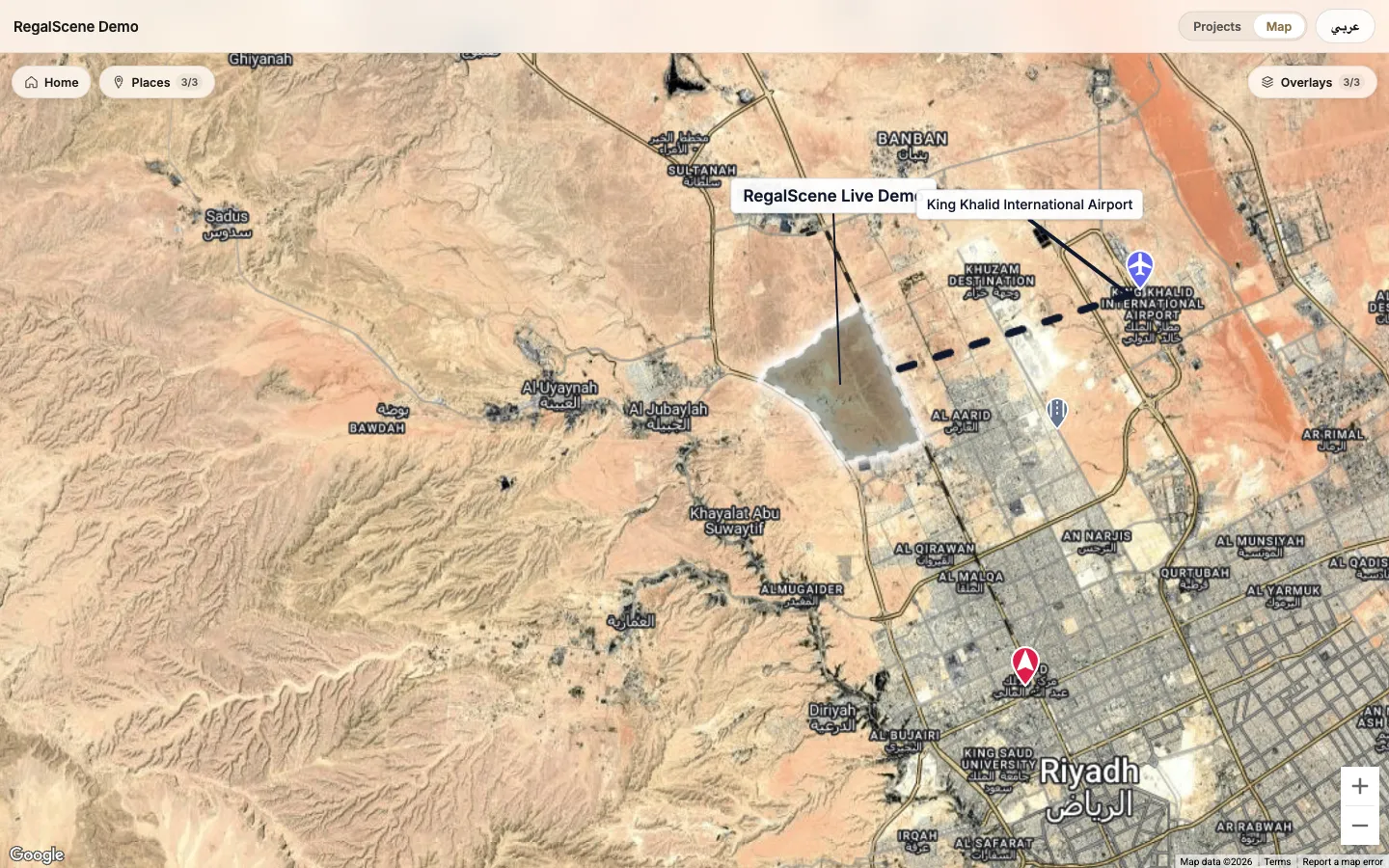
The live RegalScene geographic portfolio. Boundaries and connections are authored illustrations of each development, not surveyed lines.
Core capabilities
What the map actually does.
Each of these is in the public demonstration portfolio you can open from this page.
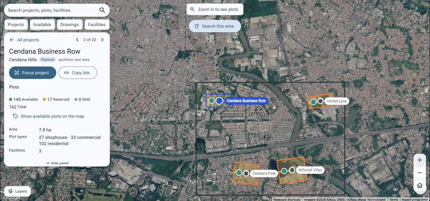
Every project on one map
Your developments placed on a real-world basemap, as one portfolio a visitor can pan and zoom rather than a list of addresses.
Boundaries, not just pins
Draw the real extent of a site as a shape, so the map shows how big the project is and where it actually sits.
Points of interest you choose
Mark the schools, malls, interchanges, coastline and landmarks that matter to your buyer, with a control that lets them turn categories on and off.
Lines and connections
Draw an access route, a rail line or a link to a landmark as an illustrated connection on the map.
Saved views
Set the view the map opens on, and save the views your team returns to, so the portfolio always opens on the story you want told first.
From the map into the project
Selecting a project opens its preview, and from there the buyer moves into the full project experience: masterplan, buildings, floors, units.
Scope
What this is, and what it is not.
GIS is a broad word, and it is worth being exact about which part of it this product covers before you evaluate it.
In the product today
The portfolio map, project placement, boundary shapes, lines, labels, points of interest with categories, saved and opening views, the buyer exploration area, the map-or-list presentation switch, and the route from a project on the map into its full experience. Everything in the section above is in this tier, and the live map below is the proof.
Configured with you, per organization
What your map opens on, which categories of place appear, how projects are styled, the area buyers can explore, the loading image it opens on, and the languages the portfolio is published in. These are authoring choices made when your portfolio is set up, not separate modules. The geographic portfolio is switched on for your organization rather than being on by default.
Not part of the product
Spatial analysis, cadastral or title validation, calculated routes and travel times, live traffic, and anything that would replace ArcGIS or QGIS. RegalScene is a presentation and sales layer over geography, not a GIS analysis engine. If your organization needs that, it stays in the GIS system you already have, and we would discuss integration separately rather than claim it here.
The real thing
Open the map we built for ourselves.
The RegalScene demonstration portfolio is public. Pan it, switch between the map and the project list, turn the places layer on and off, then select a project and keep going into its experience.
Opens in a new tab. No sign-up.
How it works
From a list of addresses to a portfolio map.
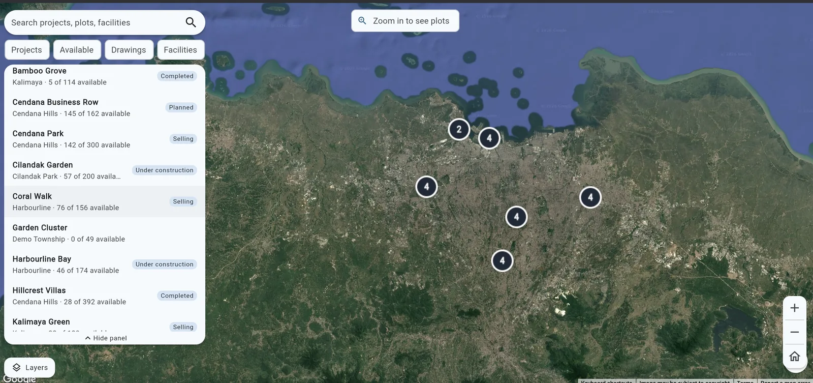
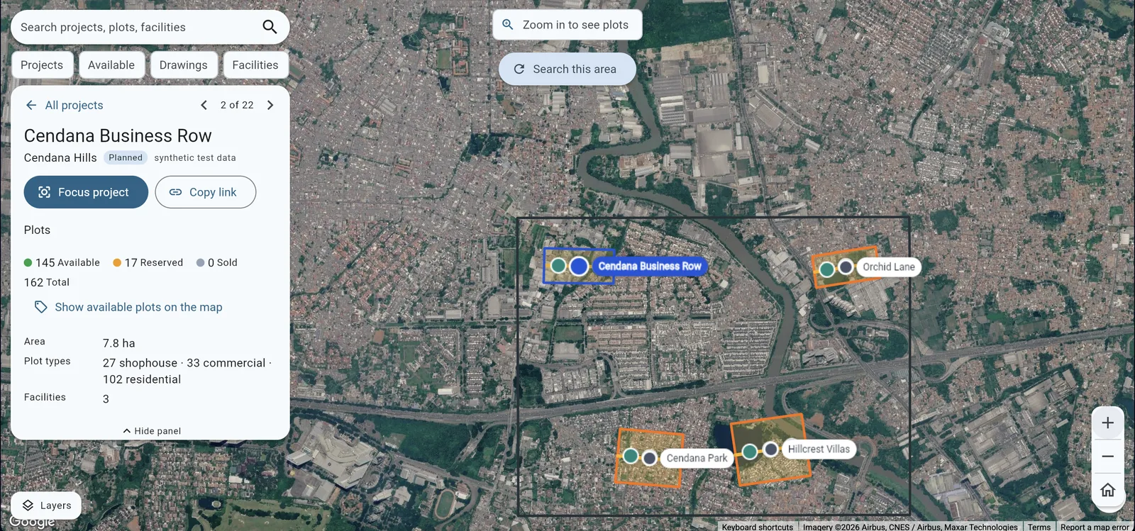
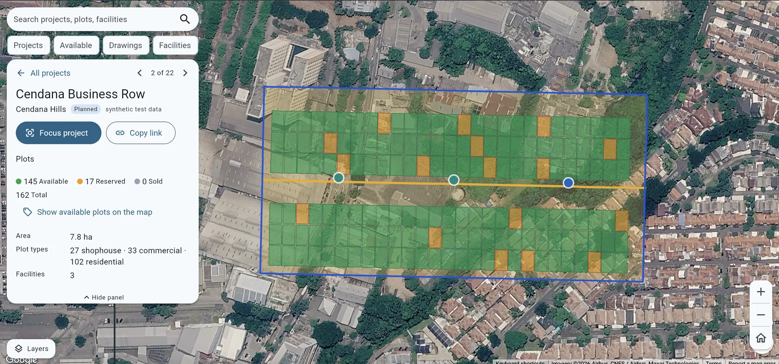
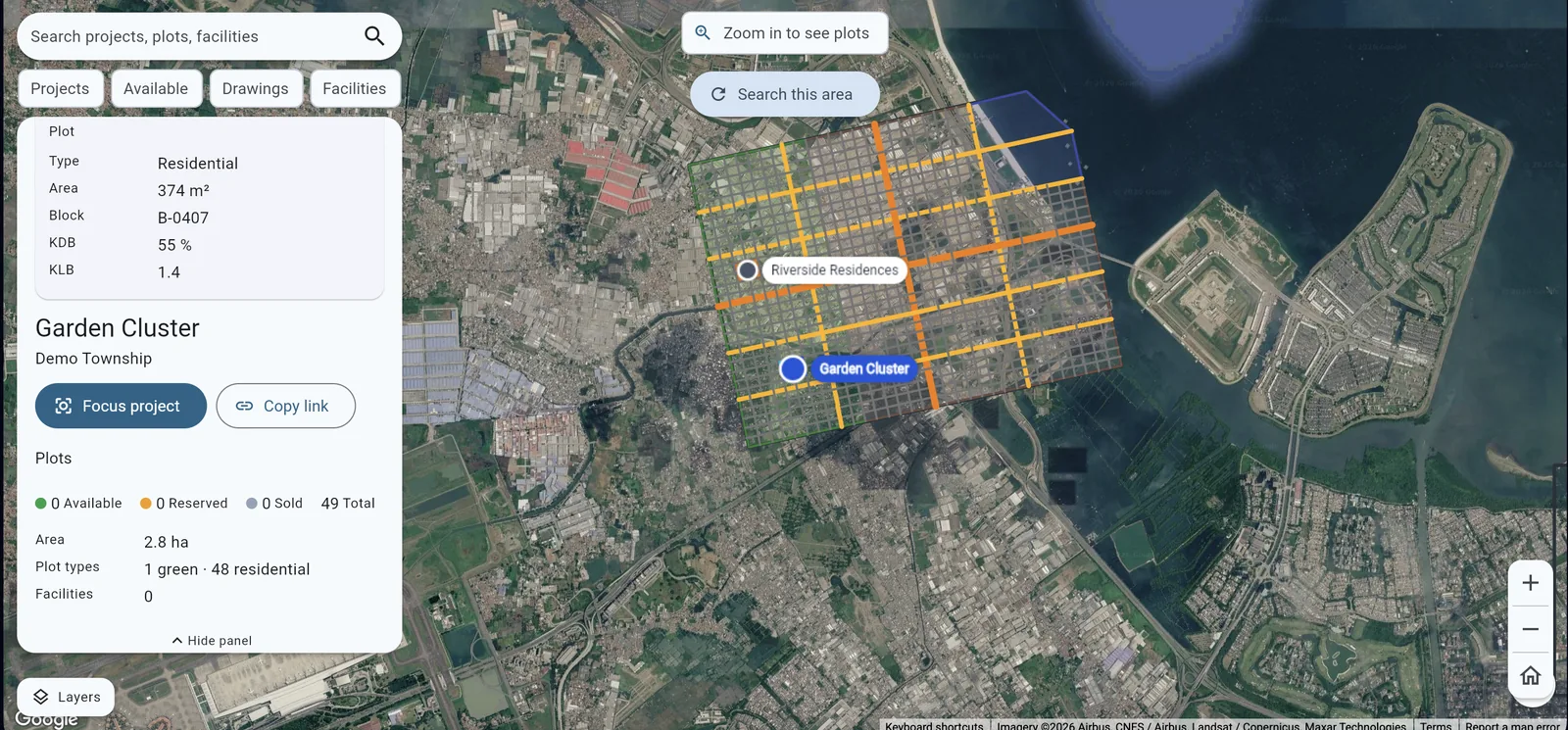
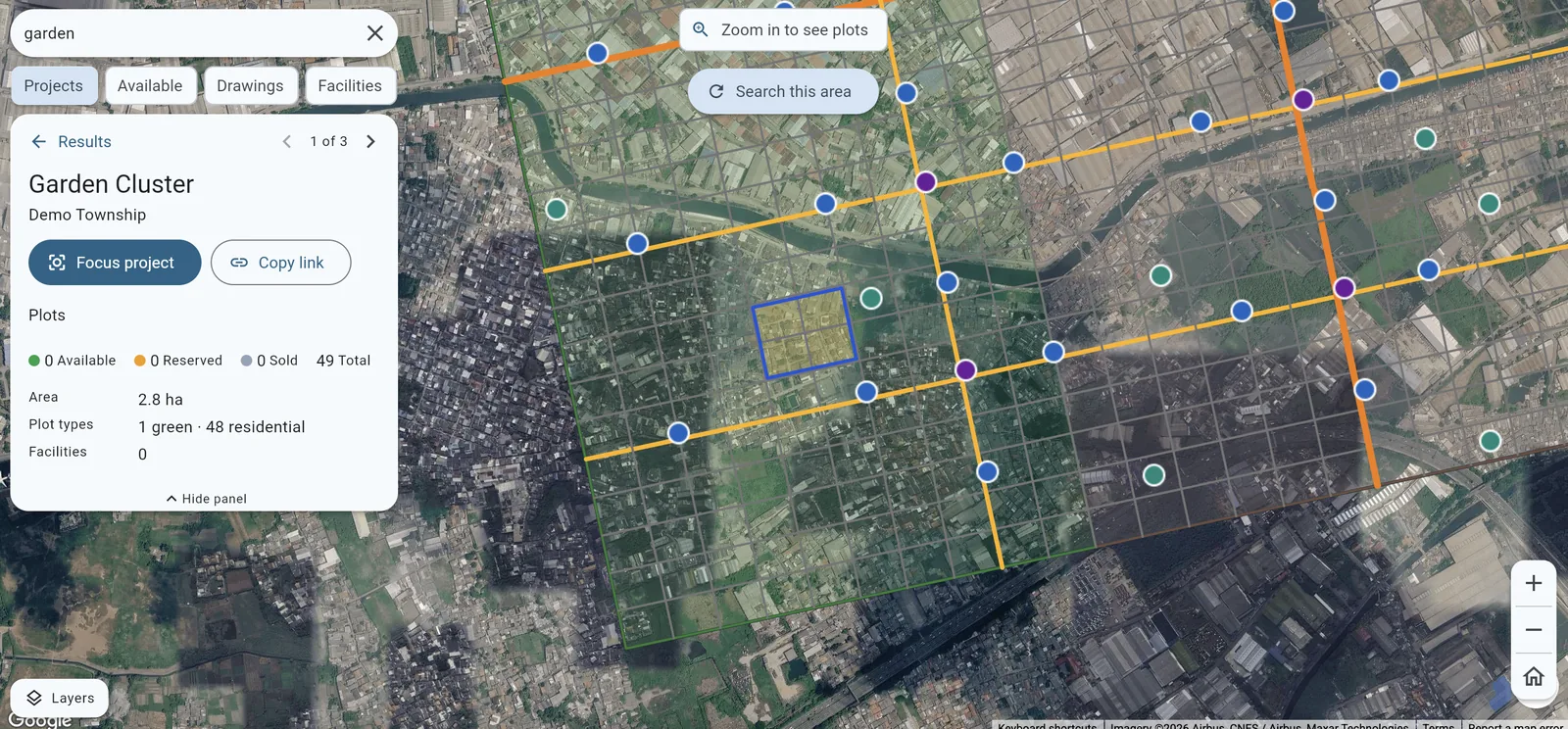
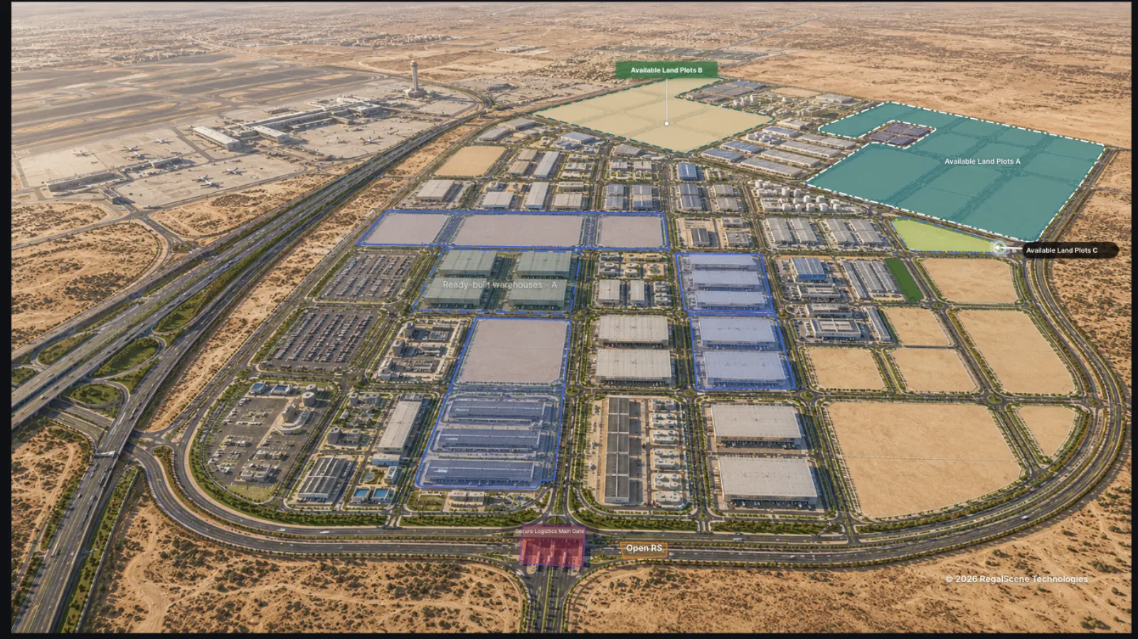
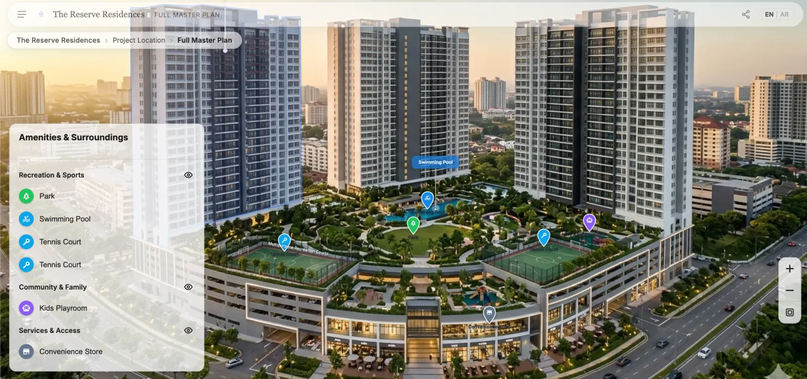
Captures from the RegalScene geographic portal, running on synthetic project data.
- 01
Your projects are placed
Each development is positioned on the map, with its boundary drawn where you want the real extent shown rather than a marker.
- 02
The context is added
Points of interest, access routes and landmarks that matter to your buyers are marked and grouped into categories they can toggle.
- 03
The opening view is set
You decide what a visitor sees first: the whole country, one city, or a single development with its surroundings.
- 04
Each project connects to its experience
Selecting a project on the map opens its preview and then its full interactive experience, so geography leads into the sale rather than ending at a location.
- 05
It is published as one destination
The portfolio becomes a public link you can put in campaigns, in your website, and in front of a buyer who asked where everything is.
- 06
Buyers choose how they browse
The same portfolio can be presented as the map or as a list of projects, and the visitor switches between them.
Who it's for
Organizations whose assets are spread out.
The more places your projects are in, the less a page of addresses does for anyone.
Large developers with many projects
Where the portfolio spans a city or a country and no single page has ever shown all of it at once.
Property groups and asset owners
Organizations holding developments across several brands or subsidiaries that need one geographic view across them.
Industrial parks and free zones
Where the product is land: plots and warehouses whose position, access and neighbours are the thing being sold.
Land and development portfolio operators
Teams presenting land banks and phased development areas where extent and location carry the value.
Geographically distributed enterprises
Organizations whose assets are spread widely enough that a map is a faster answer than a report.
Business benefits
What it changes.
The portfolio becomes visible
One place where everything you are selling can be seen at once, by your team and by a buyer, without assembling it from separate pages.
Location stops being a claim
Instead of telling a buyer the project is well connected, the map shows what it is near and lets them look for themselves.
Geography leads into the sale
A buyer who starts from where they want to live ends up inside a project experience rather than at a contact form.
Better context for planning conversations
Where the portfolio sits, what surrounds it and how projects relate geographically, in a form you can open in a meeting.
Questions
WebGIS questions.
Is this a replacement for ArcGIS or QGIS?
No, and it is not intended to be. RegalScene is a presentation and sales layer over geography: it shows developments, their boundaries and their surroundings to buyers and to your team. Spatial analysis, cadastral validation and the rest of a GIS workflow stay in the GIS system you already use.
Can it calculate drive times or routes to a project?
No. Lines on the map are drawn to illustrate a connection or an access route; they are not calculated routes, and there are no travel-time or live-traffic figures. If you want to state a drive time, it is written as content rather than computed by the map.
Can we show the real boundary of a site rather than a pin?
Yes. A project's extent is drawn as a shape on the map, which is usually far more useful than a marker for a large site. Treat the boundary as an illustration of the development's extent, not as a surveyed or title-accurate line.
Does the map have to be the first thing buyers see?
No. The same portfolio can open as a map or as a list of projects, and the visitor can switch. Which one opens first is your choice, and it often depends on whether location or the projects themselves are the stronger argument.
Can we import our existing GIS data?
Geometry is authored in RegalScene today rather than imported from a GIS system, and there is no shipped connector to one. If you hold your boundaries and site data in an existing system, treat that as an integration to scope rather than something that works on day one.
How is this different from the portfolio product?
They are two presentations of the same portfolio. The Property Portfolio Builder is the branded destination where your developments live and buyers move between them. WebGIS is the geographic layer over it: real positions, boundaries and surroundings. Most organizations use both.
Also in RegalScene
The rest of the platform.
Interactive Masterplan
Turn masterplans, renders and 3D models into one experience buyers can explore.
Digital Sales Gallery
The same project experience for your sales team, your agencies and every screen.

Where is everything you're selling?
Tell us how many developments you have and where they are. We'll show you what your portfolio looks like on one map, and what it would take to get there.