Ask five proptech vendors to "display your project online" and you'll get five different screens. Behind the variety, buyers only ever need four views — each answering one question — and the projects that convert best chain all four into a single journey. Here they are, in the order a buyer meets them, using a live three-tower city project.
1. Map view — "what is this place?"
The whole project as a navigable scene: towers outlined and labeled with their story (ownership, product, views), amenity points toggled by category, the neighborhood context visible around the edges.
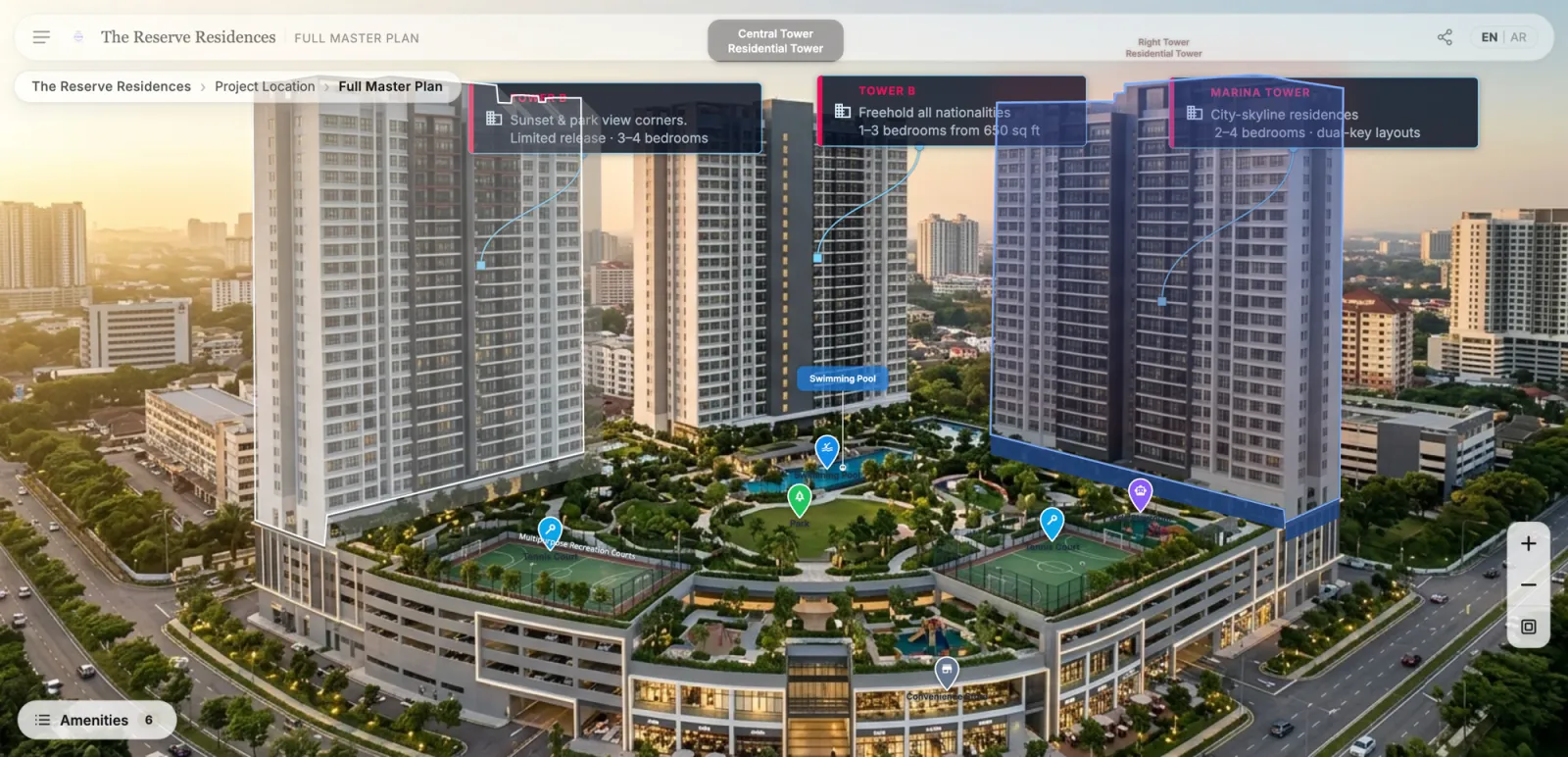
The map view's job is orientation and differentiation — each tower carries its own claim, so buyers self-select before they ever open one. It's the front door every campaign link and QR code should land on. (For master-planned townships this level does even more — the full anatomy is here.) When a developer sells several projects at once, that same map scales up into a portfolio entry point across all of them.
2. Building view — "which unit could be mine?"
Click a tower and the facade becomes the interface: every unit an outlined, selectable shape carrying live status, with the building rotatable through its angles. The buyer reads the tower the way they'd read it from the street — except this street view answers back. In a multifamily community, that same building view repeats across every tower, so a renter compares the same unit line from one building to the next.
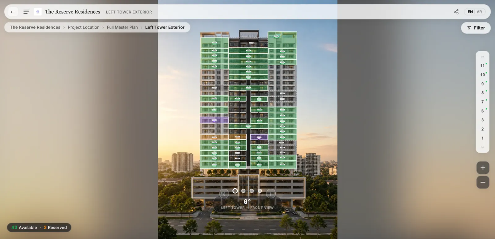
This is the view that kills the availability spreadsheet. Height, orientation, and status in one glance — "anything available on a high floor, front-facing?" takes three seconds and zero phone calls. With filtering applied on the visual, matching units stay lit while the rest recede.
3. Floor views — "what's the layout, who are my neighbors?"
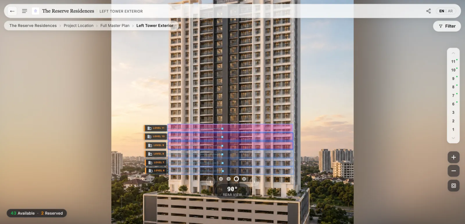
Floor views come in two complementary styles. The stacking plan renders each level as a selectable band on the facade itself — the commercial-leasing classic, equally at home on residential towers:
And the floor plate shows the level from above — every unit's layout, typology, and status on the architect's plan, with a floor rail to jump between levels:
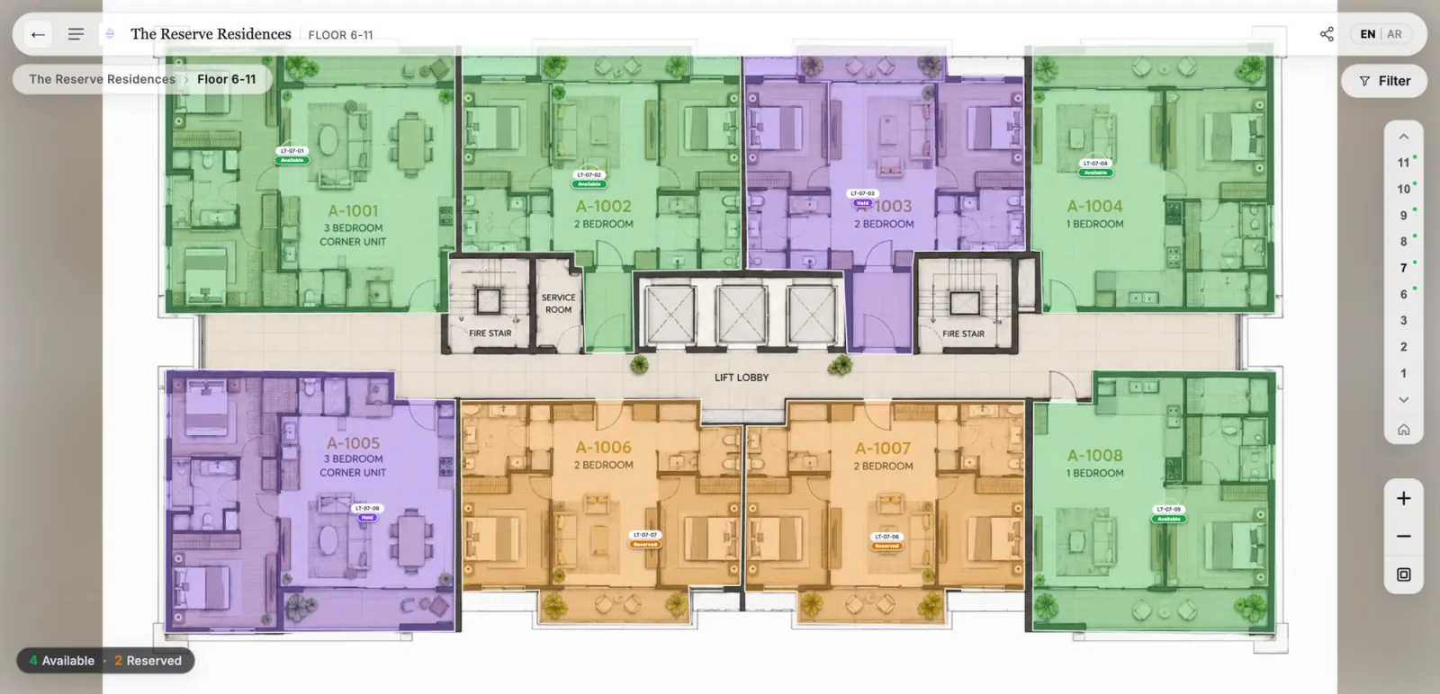
Together they answer the questions facades can't: how big is the two-bedroom really, which units share the lift lobby, is the corner unit on a higher floor still free. For typical-floor towers, one shared plate serves many levels with per-floor availability — no duplicate drawing.
4. Unit view — "tell me everything, and let me act"
The journey's end: the unit card and detail panel — type, size, orientation, price under your visibility policy (exact, range, or on request), gallery or 360 where available, and the actions that convert: register interest, callback, WhatsApp. Because the buyer arrived here through map → building → floor, the enquiry carries all of that context with it.
Why the chain matters more than any single view
Each view alone exists elsewhere — portals have maps, brochures have floor plans. What converts is the connected chain with one live data source: the same unit is green on the facade, green on the floor plate, and available on its card, and the moment it sells, every view already knows. Buyers trust what agrees with itself.
The practical takeaway for marketers: don't ask vendors "do you have floor plans?" — ask "can a buyer travel map → building → floor → unit and back, and is it the same live truth at every level?" That question sorts the market in one demo.
Related reading:
- Build an Interactive Property Experience Without Developers: From Renders to Live in Days
- Interactive Master Plan Example: Anatomy of a Real Project, Screen by Screen
- Interactive Floor Plan Software: What Real Estate Developers Should Look For
- 360° Virtual Tours for Real Estate: How Interactive Building Tours Sell Units Faster
RegalScene renders all four views from your existing assets — map, building, stacking plan, floor plate, and unit — as one connected journey with live availability throughout. Book a demo.